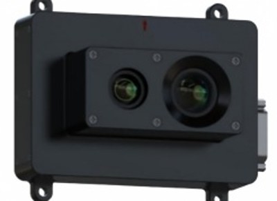
Product Overview
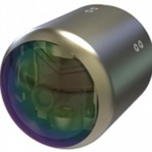
The image matching navigation module provides visual positioning for UAVs and intelligent recognition, tracking, and geolocation of ground targets, meeting the navigation and situational awareness needs of flight vehicles in GNSS-denied environments.
Features
- This module utilizes map-matching principles to calculate the flight vehicle’s position visually and outputs spatial longitude and latitude information via a serial port to the navigation control system. It adopts a compact design and is widely applicable to various UAV systems.
Technical Specifications
| Technical Specifications | ||
|---|---|---|
| Basic Parameters | Dimensions | (103×86×15)mm /(106×76×49)mm (customizable) |
| Weight | ≤200g | |
| Power Supply Voltage | 12V–32V, ≤15W | |
| Camera Type | Type | Visible Light or Infrared Camera |
| Resolution, Focal Length | Visible Light: 1920×1080(standard); Infrared: 640×512 (optional) | |
| Frame Rate | 50Hz | |
| Interface | Interface 1 | 2x RS232/UART for communication with flight control computers |
| Interface 2 | 1x Ethernet for program updates, debugging, and map data downloads | |
| Navigation & Positioning | Positioning Accuracy | ≤30m (flight altitude <300m, 1σ) |
| Positioning Accuracy | ≤5% of flight altitude (300m ≤ altitude ≤2000m, 1σ) | |
| Operating Time | Available all day | |
| Storage Capacity | Storage | 64G/128G/256GB (optional) |
| Working Temperature | Range | -40°C to +60°C |
| Integrated Navigation | Function | Supports external MEMS or fiber-optic IMU for integrated navigation, outputting position, velocity, and attitude information |
Reviews
There are no reviews yet.